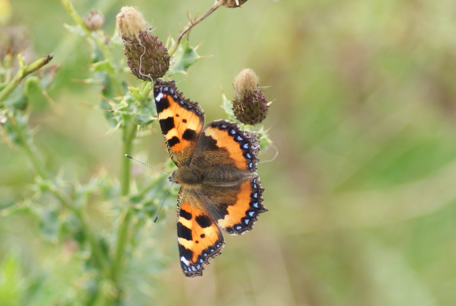
Autumn seems to be coming very early this year, so to "celebrate" I have 2 pictures of autumn along the Cam.
Both were taken from the "Backs".
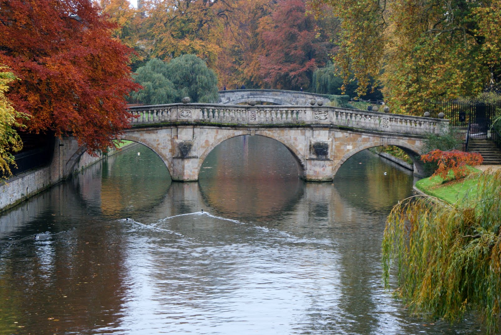
The first is of Clare College Bridge. It cams as a great surprise to find out just how large the older colleges in Cambridge actually are, and also to find out that at least some of them allow public access through the courtyards and across the bridges over the Cam. The Clare College bridge is the oldest of them, dating from 1640, and was the only one to survive the English Civil War. Perhaps due to the slightly chilly weather there are no punts to be seen, which means that the reflections of the trees add considerably to the scene.
The college itself was founded in 1326, but the building in the picture was built between 1638 and 1715: the lengthy building period being caused by the Civil War. Cambridge was actually on the Parliamentarian side, and the other bridges were destroyed by the Parliamentarian forces to make the town more easily defensible in case of need.
Thursday, 22 September 2011
Wednesday, 21 September 2011
Butterflies by the Lune
During our recent holidays we had a very pleasant walk through Lancaster, along the canal, and then down to the Lune Estuary. Late summer is always a good time for butterflies, and despite the lack of sunshine we were lucky enough to be able to photograph 2 of them.
Unlike most of its fellows, this small tortoiseshell did stay in one place long enough to be photographed. Although it's one of the most common butterflies it's very restless. The path went along the top of the dyke protecting the farmland from the high tides, but in parts was almost completely blocked by clumps of nettles and thistles.
Slightly less common is this green veined white (although it was a more docile subject!)
Tuesday, 20 September 2011
Strathy Point
About half way along the north coast is Strathy Point. It's not quite the most northerly point of the mainland, but it does lie at the end of a peninsula, and you need to walk to reach it - the road is just for access to the lighthouse and the farmer whose sheep graze the fields. The car park is at Totegan Farm, and the walk is a simple (mostly downhill) stroll along the tarmac road.
The lighthouse, like the vast majority nowadays, is automated, although the outbuildings are still inhabited. It's not one of the more picturesque lighthouses, as it sits on a rise and doesn't really need to be any taller than it actually is. It's a modern lighthouse, dating from 1958, and was the first one to be built as an all electric station. It filled in the last dark gap on the north coast, and the light can be seen for 26 miles. There had been a temporary light there during the Second World War, and eventually it was concluded that it was really necessary.
But the lighthouse isn't the main reason for the walk.
If you go across the moor to the left of the picture, to this side of the lighthouse, you come to a small cliff with a view of a small sea arch.
We were lucky: the tide was just at the best height to appreciate it, and there was a small sea running, which really helped pick the arch out from among the dark rocks. The mass of rock in the foreground is geologically very interesting. There's a very old gneiss outcrop here among the mainly sedimentary rocks, possibly over 3,000 million years old - although the geologists aren't totally sure!
Labels:
lighthouse,
Scotland
Location:
A836, Highland KW14 7, UK
Stacks of Duncansby
It's a bit of a truism to say that in Scotland you can expect 4 seasons in one day, but the weekend that we spent on the North Coast seemed to prove it. The day after I took the pictures of Moine House and Ben Loyal the weather changed completely, starting with heavy rain and continuing with a gale force wind that made standing still very difficult, let alone taking photographs. Nevertheless we made our way (inevitably) to John o'Groat's and found enough shelter to take this picture of the Stacks of Duncansby.
I had been to the stacks before, but on that occasion it had been quite foggy - the stacks swam into and out of vision, so I was pleased to be able to find the visibility much better this time.
It's a good job that the stacks are so spectacular, because we also included a visit to the nearby John o'Groats, which really seemed to be suffering already from the threatened recession: it doesn't give a good impression to visitors if the most prominent building, the hotel, is obviously fairly permanently closed! But that was the year (2010) that it won the Carbuncle Award for the most dismal place in Scotland. In fairness, they have just (as in about a fortnight ago) started a £6 million refurbishment project which will include a redevelopment of the hotel, and nothing can take away from the scenery!
Location:
A836, John O' Groats, Highland KW1 4, UK
Monday, 19 September 2011
Moine House
A few miles west of Tongue, on the North coast of Scotland, are the remains of Moine House. It's in the middle of the Moine, a vast area of peat and heather moor between the Kyle of Tongue and Loch Eriboll, and served as a refuge for travellers. Behind it is Ben Loyal, which with Ben Hope (behind the photographer) dominates the landscape of this part of Scotland.Unsurprisingly the main peak of Ben Loyal is called "An Caisteal", or "The Castle". Much of the bulk of the mountain is hidden below the ridge. You get a much better view from Tongue itself.
We were very lucky with the light when we were in Tongue: although there had been a lot of rain earlier in the day, the sun came through with quite amazing clarity.Part of the reason that I like the picture of Moine House so much is the way in which the remains of the front which had brought the rain are still visible.
These pictures actually date from last summer - there haven't been many days like this in this summer in Scotland!
Sunday, 18 September 2011
Crook O'Lune
This picture is just downstream of the previous entry. The trees on the left hand side normally stand well clear of the water.By this time the Lune has changed course by almost 180 degrees, and is flowing in the opposite geographical direction. Because of the change in the structure of the rocks the current seems much faster, and the colour of the water shows how much soil is being washed downstream. The hills in the background are the northern edge of the Forest of Bowland, one of the few areas in the North West of England that could be described as wilderness.
Turner's view of the Lune
JMW Turner visited the North of England on a number of occasions, painting either for later sale or on commission. One of the views that he painted was this one of the Lune Valley at the "Crook O'Lune". Just behind the viewpoint the Lune makes a hairpin bend as it cuts through harder rock on its way to the sea south of Lancaster.It didn't look like this when he visited, though. The river is normally only about 100 yards wide, and most of the trees you can see are not even near to the riverbank. You should also be able to see Ingleborough in the background!
The Lune does have a tendency to flood here: the Crook O'Lune restricts the water flow, and the main gathering grounds are not very far upstream. Fortunately the floods also recede relatively quickly: 12 hours after this picture was taken the water had returned to normal levels.
Subscribe to:
Posts (Atom)